When it comes to improving safety, accuracy and efficiency at IRWD — the sky is the limit.
Our award-winning Enterprise Drone Program is using Unmanned Aerial Vehicles to improve efficiency up to 66% and save $250,000 or more each year.
Drone technology is a cost-effective tool that offers faster, safer and more precise data collection. Enacted last year, the program is saving money, streamlining the use of staff time and providing better data to improve the work we do. Some typical uses and annual results include:
Water sampling
$50K savings in staff time
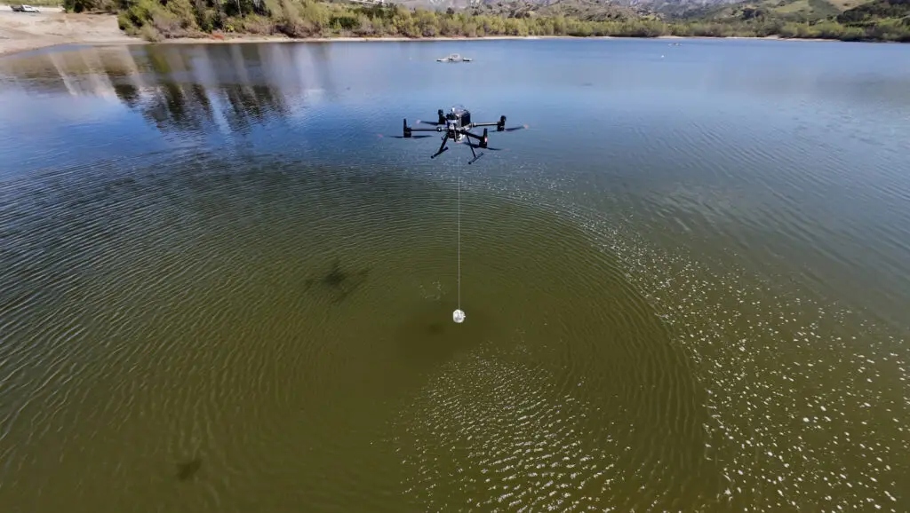
Drone-assisted water sampling has reduced typical field time by two-thirds: from about 90 minutes using an amphibious vehicle to about 30 minutes per flight. Using GIS waypoints, testing locations are repeatable. This approach significantly reduces staff time and exposure to on-water risks while accelerating sample collection and response.
Water loss
Helps identify unauthorized water use and theft
For water-loss investigations, drone surveillance from the air uses a high-zoom aerial sensor to identify unauthorized water use in construction. This provides the evidence needed for the District to engage directly with developers and contractors, and maintain consistent records with smart forms and surveys. This enhances water-loss prevention and allows for cost recovery, when appropriate.
Aerial photography
$125K savings in aerial imaging costs on infrastructure inspections
The program has been documenting District-owned assets using aerial photography, photospheres, and videos. These records allow staff to visually assess infrastructure remotely, reducing routine site visits. In the event of a disaster, this documentation strengthens FEMA reimbursement efforts by providing pre-incident visual records of assets.
Orthomosaic mapping
High-accuracy aerial imagery improves infrastructure mapping and planning
The introduction of RTK-enabled orthomosaic mapping is improving spatial accuracy and expanding the usefulness of drone data. With high-accuracy aerial imagery, IRWD will be able to precisely map assets as they are being constructed and provide up-to-date records.
“The program received state honors this year from the California Special Districts Association,” said Enterprise GIS Manager Cameron Smith. “And, with new applications being developed every day, benefits are expected to continue to grow over time.”